Intracoastal Waterway Travel Time
The Intracoastal Waterway (ICW) stretches along the Atlantic and Gulf coasts of the United States. Moving from Florida to the Northeast or down the Gulf Coast, it’s a preferred route for many boaters. Understanding the travel time along this waterway requires consideration of multiple factors.
Distance and Basic Geography
Spanning about 3,000 miles, the ICW links natural inlets, rivers, bays, and canals. Its journey from Boston, Massachusetts, to Brownsville, Texas, offers diverse scenery. The Eastern Seaboard segment measures roughly 1,200 miles. The Gulf Coast Canal runs approximately 1,350 miles. Time estimates can vary greatly, influenced by boat type and speed.
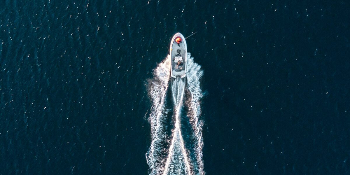
Boat Types and Speeds
Three main types of boats typically use the ICW: sailboats, powerboats, and trawlers. Sailboats often move at 5-6 knots. Powerboats, on the other hand, can cruise between 18-25 knots. Trawlers, being heavier, usually proceed at 7-10 knots. Knowing your boat’s average speed is crucial for calculating travel time.
Understanding Knot Speed
A nautical mile equals approximately 1.15 statute miles. Knot speed helps in estimating travel time. For instance, if you’re cruising at 10 knots, anticipate covering 10 nautical miles per hour. Hence, a 120-mile segment could take around 12 hours of travel without interruptions.
Tide and Current Factors
Tidal currents impact travel time noticeably. Going against the current will slow your pace. Conversely, traveling with the current increases speed. Timing departures with the tidal schedule optimizes traveling efficiency. Ensure regular checking of tidal charts and current flows.
Weather Conditions
Weather significantly affects progress. Strong winds, heavy rains, or fog can slow down travel and decrease visibility. Monitoring weather forecasts for your planned segments can help avoid delays.
Navigation and Bridges
Over 100 bridges span the ICW. Some are fixed and others are drawbridges. Drawbridges often adhere to schedules, opening at specific times. Arriving early might mean idling while waiting for the next opening. Fixed bridges with lower clearance might require detours, impacting travel time.
Locks Along the Way
Locks on the ICW, particularly in the Okeechobee Waterway, add to journey length. Each lock transit may take 30 minutes to an hour, depending on traffic. Factoring in lock waits ensures a realistic travel plan.
Anchorages and Marinas
Safe spots to moor are critical for extended journeys. Research and planning for anchorages or marinas will determine nightly stopping points. Proximity to shore facilities influences your nightly docking decisions.
Fuel and Supply Stops
Sufficient fuel and supplies determine travel autonomy. Running multiple systems on board, including navigation, can consume power quickly. Estimating fuel consumption rates lets you plan appropriate fuel stops along the ICW.
Health and Safety
Prioritizing health and safety is essential. Medical emergencies can disrupt schedules. Keeping a stocked first aid kit and updated emergency contacts is vital. Awareness of the nearest medical facilities along the route also provides peace of mind.
Daily Mileage Expectations
Realistically estimating daily mileage is key. Most boaters average 50-70 miles a day. This estimate accounts for leisurely travel, daily stops, and contingencies. Pushing beyond this can be tiring and unsafe.
Sample Itineraries
For example, traveling from Miami to Norfolk, a distance of approximately 1,000 nautical miles, could take around 20-25 days at an average speed of 6 knots. Breaking this into daily segments, accounting for stops, gives a manageable pace.
Technology and Tools
Modern technology simplifies route planning. GPS systems, navigation apps, and marine charts help plot detailed courses. Reliable tools reduce guesswork, enhancing safety and efficiency.
Local Regulations
Different states along the ICW may have varied boating regulations. Understanding local rules ensures compliance and safety. This includes speed limits, licensing requirements, and environmental guidelines.
Wildlife and Conservation Areas
Numerous conservation areas and wildlife reserves line the ICW. Following designated pathways minimizes ecological impact. Enjoy wildlife sightings while respecting their habitats.
Community and Communication
The ICW connects a vibrant boating community. Joining forums or groups provides valuable insights. Sharing experiences makes the journey more enjoyable and informed.
Learning Resources
Numerous books, guides, and online resources offer in-depth knowledge. Reading up on the ICW equips travelers with essential tips and historical context.
Budgeting and Costs
Budgeting for an ICW trip involves calculating fuel, docking fees, supplies, and maintenance. Detailed financial planning prevents unexpected expenses.
Historical Context
The ICW has historical significance. It originated from an 1800s vision to create a safe, navigable inland route. Its evolution reflects centuries of maritime strategy and engineering.
Sustainable Practices
Adopting sustainable boating practices preserves the ICW for future generations. Simple measures like waste management, energy-efficient appliances, and eco-friendly products contribute to conservation efforts.
Personal Story and Experiences
Every boater has unique experiences along the ICW. Sharing personal stories, like encountering fellow travelers or overcoming challenges, enriches the collective narrative.
Adjusting Expectations
Maintaining flexibility in travel plans is important. Unexpected delays or detours are common. Embracing the journey with an adaptable mindset enhances the overall experience.


Stay in the loop
Get the latest passage maker mag updates delivered to your inbox.